Resources
Props
- Bunch of tubular webbing pieces/rope
Step-by-Step Instructions
- Supply your group with a bunch of long lengths of tubular webbing (or ropes.)
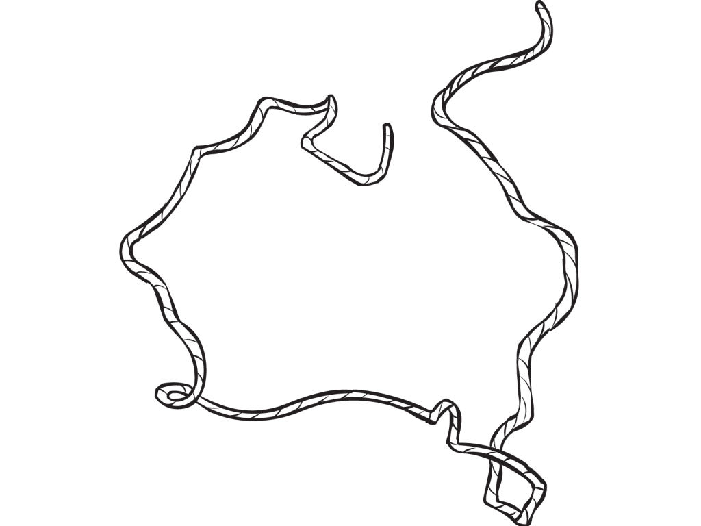
- Challenge your group to lay the webbing onto the ground to represent the two-dimensional shape or map of the world (or township, or state, etc.)
- Encourage your group to work collaboratively to produce a map, as accurate as possible.
- Allow 10 to 15 minutes to complete the task.
- Once completed, consider using the map as a reflection tool (see Reflection Tips tab.)
Video Tutorial
Video Transcript for Map Making
presented by Mark Collard
I’m going to ask you, for this exercise, as a group and this is a large group to work with, but it won’t take too long. Do not look at the nth degree of perfection. I just want to get a basic map of the world on this floor.
Where I’m standing right now, just to give you some context, is Antarctica. So it’s one of the continents. So it’s white, I’ve used that definitely for a purpose.
So as I’m looking at the map, appreciate it’s mostly the way we look at the map. It’s that Antarctica is on the bottom, then of course you’ve got the Americas on the right, you’ve got Africa on the left, and then there’s Europe, and there’s Russia, and Asia.
Your objective now as a group, again just take the next couple of minutes, with these loops and I think you’ve only got eleven or twelve loops left, I want you to create the major parts of the world map as relative to each other as is possible.
Got the idea? Go.
(Group begins map making)
Feel free to make a bit more space there too if you want.
So take, take a little step back from our world map.
Let’s just get a sense for what we have at the moment. We can all argue, of course, what’s working and what’s not working.
So clearly we’ve got something of Europe and Africa. This is Eurasia and Asia over here, Australia, Antarctica, then there’s this huge Pacific Ocean, and then the Americas. Is that about right? Okay cool, alright.
In and of itself, particularly when you’re working with small groups, this can be a task for your group to solve that problem. It could be something of accuracy. So if you happen to be working something in the area of geography, getting this accurate, but I’ve used the world map. You could do it just of Victoria or Australia, or of your local community.
You know I’ve worked with groups where they actually have to map the major centres of their little town. So there’ll be the post office, the town hall, you know the quarry, the swimming pool. So they get a sense of perspective, but either way you then now have a map to now work with. And as I’ve said you can make this as your problem to be solved, I’m now going to add more to it.
I’m going to ask you now to move to different parts of the map according to your response to a series of questions. Earlier I asked you, asked you, what part of the world would you describe as paradise? I’d like you now to move to that part of the world as it’s represented by this map that represents paradise.
(Group moves to their own individual paradise on the map.)
You can make it whatever you want.
Okay, so there can be a little bit of where is what I’m looking for because it’s not necessarily accurate, and I gave you limited resources. But for now regardless of whether you’re in the right spot or not find one or two people around where you are standing and share with them, What was that space that you believed to be paradise and tell them why. Go.
(Group begins to discuss with each other.)
Last couple of questions, again moving to that part of the world, earlier I asked you about paradise, but this is a slightly different question. Which part of the world, it may or may not be paradise, but would you’d love to go to but you’ve not been to yet?
For example I would pick Antarctica, but which part of the world would you love to go to that you’ve not been to yet? When you get there share with people around you why.
(Group begins to pick their spots on the map and discuss.)
You all right?
How To Play Narrative
This exercise developed out of an interest to help a particular group of students to become more aware of their local surroundings. And creating a visual representation of just that was the ideal geographic tool.
In advance, you’ll need to gather at least 10 or more long lengths (3 to 4 metres) or pieces of 25mm tubular webbing. Rope works fine, too, preferably thicker than 5mm.
Gather your group in the centre of an open space, and place the webbing lengths in the middle.
Explain that you would like the group to lay all of the webbing pieces onto the ground to create a two-dimensional representation of, let’s say, the map of the world (see Variations tab for many other ideas.)
In effect, you are asking your group to use the lengths of webbing as if they were producing a line drawing of the various continents and countries of the world. Naturally, everyone will bring their own perspective on the shape and relative sizes of the various objects they are trying to replicate.
Allow ample time for your group to collaborate and solve problems along the way.
When the group believes that they have created a map as closely resembling the real thing, invite everyone to stand back and take in the big picture.
From here, choose to reflect on their map-making process, and/or choose an alternative reflection strategy (see Reflection Tips tab.)
Practical Leadership Tips
If your group is larger than 15 people, I would suggest dividing it into smaller teams of no more than 12 people, perhaps completing the same exercise but in a neighbouring location. If creating a map of the world, you could ask one team to focus on the northern hemisphere, while the other creates the southern hemisphere.
While not important, try to source a set of tubular webbing (or other cordage) in different colours – the final result is far more visually attractive.
Depending on how complex you wish to make this exercise (and the abilities of your group,) you may permit your group to use existing maps and other resources on which to guide their construction.
Unless your subject is geography or town planning, don’t stress, nor let your group stress too much over the accuracy of their ‘maps.’ The process by which the map is created is often more important.
Social-Emotional Learning
You could integrate Map Making as part of a well-designed SEL program to establish and maintain healthy and supportive relationships and to effectively navigate settings with diverse people.
Specifically, this activity offers ample opportunities to explore and practice the following social & interpersonal skills:
Self-Management
- Demonstrating Self-Discipline & Self-Motivation
- Setting Personal & Group Goals
- Taking Initiative
- Use Planning & Organisational Skills
Social Awareness
- Taking Other’s Perspectives
- Demonstrating Empathy & Compassion
- Understanding & Expressing Gratitude
- Appreciating Diversity
- Recognising Strengths In Others
- Respecting Others
Relationship Skills
- Communicate & Listen Effectively
- Seeking and/or Offering Support
- Build Positive Relationships
- Demonstrate Cultural Competency
- Work Collaboratively
- Showing Leadership
- Resolving Conflict Constructively
Responsible Decision-Making
- Demonstrating Curiosity & Open-Mindedness
- Making Reasoned Judgements
- Identifying Solutions
- Anticipating & Evaluating the Consequences of One’s Actions
- Promoting Personal & Collective Well-Being
You can learn more about SEL and how it can support character education here.
Health & Wellness Programming
There is no specific health & wellness perspective to this activity other than promoting the benefits of being creative and promoting a collaborative spirit in oneself.
In a small way, you could argue that the focus required to interact and engage with others to create a cohesive map may speak to the benefits of having developed a set of supportive and healthy behavioural norms in advance. Or, if not, you could focus on any less-than-desired interactions or outcomes to explore what sorts of behaviours your group would prefer to see. For example, you could invite your group to reflect on a variety of full value behaviours such as:
- How did the group demonstrate its ability to care for self and others?
- How did the group make its decisions? How were all members involved?
- What types of leadership were demonstrated during the exercise?
- In what ways did the group’s adaptability help it be successful, or not?
If you can think of more explicit ways in which Map Making could be purposefully integrated into a health and wellness program, please leave a comment at the base of this page.
Popular Variations
- World Loops: Tie a knot in the two ends of each length of webbing to create a loop. Now, the group will attempt to re-create a map of the world using this bunch of loops.
- Map As A Process: Use the ‘map’ your group has created as a reflection tool (see Reflection Tips tab.)
- Local Map Making: Ask your group to utilise the lengths of webbing to accurately reflect the shape of:
– The floor plan of the building(s) they are situated;
– Their school, camp or organisational grounds;
– Local community/township or shire;
– Anatomy of the human body;
– Schema of a mechanical device, eg engine;
– Any physical item or being, eg fauna and flora, etc.
- Contextual Map: Take a look at Mapping to offer your group a different ‘mapping’ perspective.
You Might Also Like...
free
Are You More Like…
Series of questions which help identify difference.
7
Five Clues
Curious get-to-know-you-better game for all groups.
8
Island of Healing Circle
Gentle, mindful exercise to prepare groups to share.
Useful Framing Ideas
One of the most fascinating aspects of gaining altitude (from climbing a mountain, or looking out of a aeroplane window) is the benefit of perspective, or the ability to see things from above. Only when we choose to step back from a certain place, can we truly understand how everything fits together. This next map-making exercise will provide us with an opportunity to do just that…
Most of us have the ability to recognise the shape of, say, our township, state or country, or some other physical object, when we see an image of it in front of us. However, few of us are very good at drawing an accurate picture or map of what these objects look like purely from memory. Let’s see how you go…
Reflection Tips & Strategies
Coupled with one or more reflection strategies, here are some sample questions you could use to process your group’s experience after playing this terrific problem-solving exercise:
- What observations did you make when you first stood back to view the map? How did this make you feel?
- What parts of this exercise were the most difficult? Why?
- Do you think your group achieved a better/more accurate result than if you had created the map on your own? Why?
More particularly, the finished ‘map’ will provide your group with many reflection opportunities. For example, if your group has created a map of the world, you could ask “Stand on that part of the world that…”
- You would love to visit;
- You would never want to visit;
- Is known to represent one of your favourite cuisines;
- Has featured in the news lately, etc.
With each question, ask individuals to share with one or more people close to them why they are standing where they are standing.
Source
I’ve found this to be a great opening activity even for groups up to 25. It is a great way to learn new things about one another in an activity that is very non-threatening. I also gives me the facilitator a little insight about the group.